

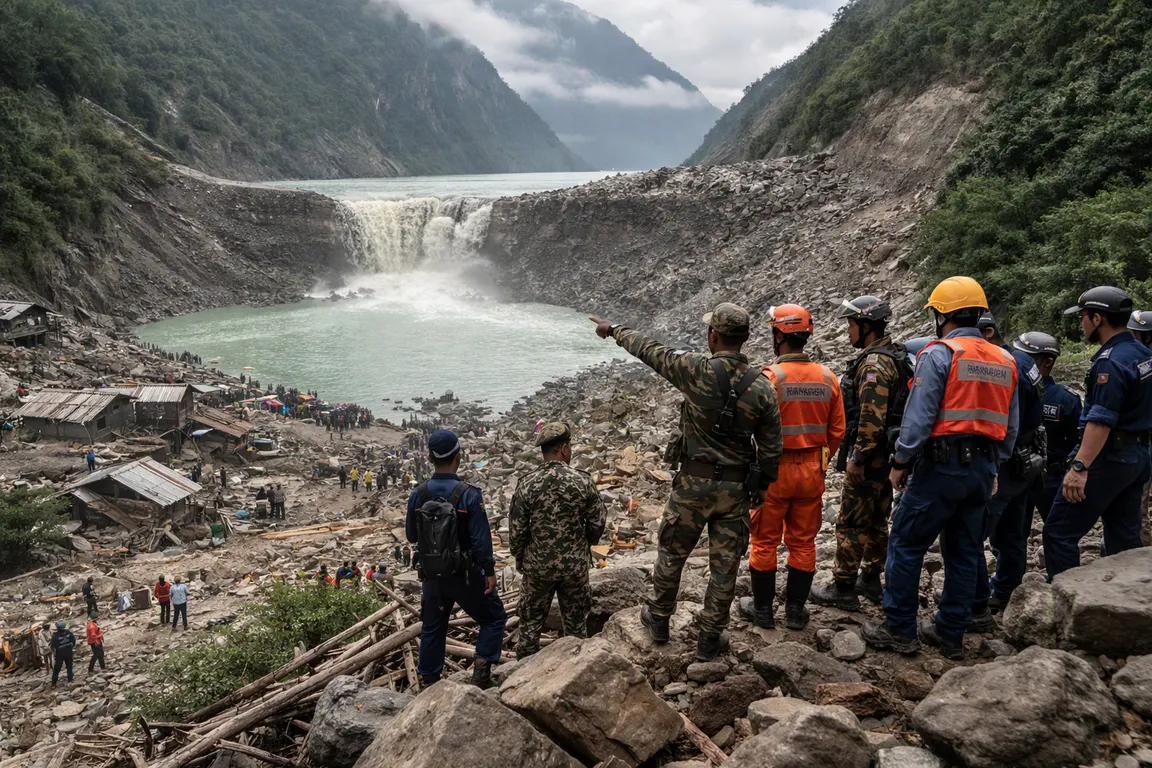
A newly formed 27‑acre barrier lake behind a natural dam is spilling over its ridge, prompting Chinese and Nepali authorities to warn of an imminent breach that could unleash a second surge into the already devastated floodplain.
Rescue crews are still sifting through debris from the Aug. 26‑27 flash flood that killed hundreds, left more than 1,400 people missing and crippled the vital trade artery at Gyirong Port. The lake, created by the same mudslide that blocked the Chhochen Khola and Purepu Tsangpo rivers, holds roughly 2 million cubic metres of water and could swell by another 3 million cubic metres within three days, according to China’s Ministry of Water Resources.
If the natural dam fails, the downstream surge could inundate Gyirong Port, sever cross‑border supply routes and add thousands of casualties to an already massive humanitarian crisis.
The barrier lake formed near the confluence of the two rivers, about 18 km upstream of the Rasuwagadhi border point. Drone footage released by Xinhua on Aug. 27 showed water already overtopping the dam’s crest, while Chinese rescue teams are using 3‑D laser scans to map the dam’s geometry before any debris‑clearance work begins. The inflow rate, estimated at 15 cubic metres per second, is feeding the lake faster than it can be drained, and forecasts from China’s National Meteorological Center call for moderate‑to‑heavy rain through Aug. 29, raising the breach probability.
The initial disaster stemmed from a glacier‑rock collapse triggered by extreme heat, according to reports from Al Jazeera and The Guardian. Nepal’s National Disaster Risk Reduction and Management Authority (NDRRMA) reported 359 bodies recovered and 910 missing, while the Gyirong disaster command in Tibet listed three deaths and 558 missing, including 260 foreign nationals.
Beyond the human toll, the lake’s growth threatens the region’s economic lifeline. Gyirong Port, the main conduit for Sino‑Nepal trade, handles an estimated $300 million of goods each year. A breach would flood the port’s approach roads, delay aid convoys and disrupt essential supplies to remote villages still cut off by landslides.
International aid agencies, already grappling with limited access, warn that rising water levels could block the only viable routes into the hardest‑hit communities. Authorities have issued evacuation warnings for settlements along the downstream riverbanks and are deploying drones to monitor water levels in real time.
Chinese officials say they are prepared to release water through controlled spillways if the dam’s stability deteriorates, but engineering assessments are still underway. Nepal’s disaster management agency is coordinating with Chinese counterparts to synchronize evacuation drills and pre‑position relief supplies on higher ground.
The situation underscores a broader pattern of climate‑linked mountain hazards that strain regional disaster‑response capacities. While lake‑volume estimates are consistent across sources, the projected inflow lacks independent verification, and terms such as “barrier lake,” “dammed lake” and “natural dam” are used interchangeably, adding to public confusion.
As rain continues and the lake swells, officials face a critical decision: attempt a controlled breaching of the dam or focus on reinforcing downstream defenses. Both options carry significant risk, and the window for decisive action narrows each day. Monitoring data from drones and laser scans will inform that decision, but for now residents and traders along the Bhote Koshi river remain on high alert, awaiting the outcome of a precarious balance between water and rock.